MAP REPRODUCED COURTESY OF NORFOLK COUNTY COUNCIL
Registered Charity No 1108814
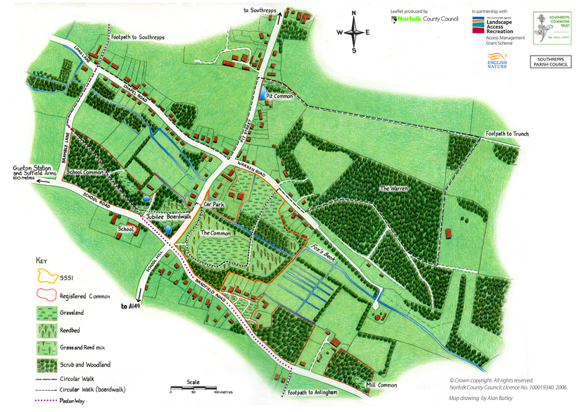
Southrepps Commons Local Nature Reserve comprises five adjoining sites spreading over 25 acres in the village of Lower Southrepps. They are Southrepps common itself ("The Common"), School Common running through, Pit Common, Mill Common and Bradfield Road Common. Warren Woods is privately owned but can still be enjoyed from the public footpath through. To orientate yourself and find how to get there use the "multimap" link.
Southrepps Common, in the centre of the plan below, enjoys protection as a Site of Special Scientific Interest. This is the botanically rich area where you can see wild orchids, cottongrass, bog-bean, etc., wander along the extensive boardwalk between tall reeds, and play Pooh-sticks on the bridge over Fox's Beck.
The pond on Pit Common is well-stocked with native fish and home to moorhens and mallard. Locally called The Pit, it was re-excavated in autumn 2009. We have grand hopes for the area behind The Pit which will recover in time.
School Common is largely woodland which our local primary school uses for teaching. The pond shown besides the cross roads is the site of our latest, on-going project. When complete, there will be a secluded and safe area, with a dipping platform large enough to accommodate a whole class of children and associated adults.
This plan is available from our information kiosk at the car park. Please use it on its own or, better still, in conjunction with other maps to plan a longer walk. For the enterprising walker there is an endless variety of footpaths ranging as far as Bradfield, Trunch, Southrepps and even the sea.
MAP REPRODUCED COURTESY OF NORFOLK COUNTY COUNCIL